National Reserves in Lamu

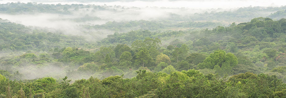


Boni National Reserve: A Rarely Travelled Park
On a much grander extent and more easily approached from Lamu is the 1,339 km2 Boni National Reserve situated at the extreme southeast corner of Garissa County in between Dodori National Reserve, in Lamu County, and Lag Badana Bushbush National Park, in Somalia. Established in 1976 as a dry season refuge for elephants and other wild animals, this far-out backwoods reserve, covering a sizeable patch of indigenous coastal forest has a genteel collection of invaluable hardwoods many of which are listed as very rare, vulnerable or endangered.
Boni’s 680 km2 forest section is the only noted forest in Garissa County. Enclosed in this rarely visited forest are many ancient sacred and traditional groves used by the Bajuni, Somali and Boni Communities as well as a handful of historic sights and cultural landmarks. The open canopy forest of Boni National Reserve is a part of the broad and continental Northern Zanzibar-Inhambane coastal forest. In recent years, it has gained unwelcome notoriety as a ‘lair’ for the Al Shabaab.
In spite of identifying themselves as Muslims, the splinter Boni retains sacred forest shrines to protect their spirit world. The destruction of Boni Forest and the expropriation of the land now poses a grave threat to their survival and the loss of a major biological diversity. “Numbering about 3,500, the Boni are one of the most marginalized indigenous cultures in Kenya, and they are threatened with losing their land, their livelihoods, their way of life, and perhaps their very lives” – Chonjo, Issue 11. Sometimes known as Aweer, Boni live in the forested patch between Boni and Dodori National Reserves, and southwest of Dodori Reserve towards the tail end of Dodori Creek in what is known as the Boni-Lungi Forest.

Kenya certainly has enormous touring resources. There are no less than sixty national narks, reserves and game sanctuaries, covering approximately 11% of the land surface. Each of these diverse and stunning national parks and reserves offers unique wildlife experiences and unique, breathtaking landscapes.
Index of National Parks & Reserves in Kenya


Baringo County - Lake Baringo National Reserve, Lake Bogoria National Reserve, Kerio Valley National Reserve, Lake Kamnarok National Reserve, Bomet County - The South Western Mau National Reserve, Busia County - Malaba Sanctuary, Elgeyo Marakwet County - Rimoi National Reserve, Embu County - Mount Kenya National Park; Irangi Forest Station, Mwea National Reserve, Garissa County - Bour-Algi Giraffe Sanctuary, Rahole National Reserve, Arawale National Reserve, Boni National Reserve, Homa Bay County - Ruma National Park, Isiolo County - The Bisanadi National Reserve, Buffalo Springs National Reserve, Shaba National Reserve, Kajiado County - Amboseli National Park, Kakamega County - Kakamega National Reserve, Kilifi County - Arabuko-Sokoke Forest Reserve, Watamu Marine National Park, Malindi Marine Reserve, Kisumu County - Kisumu Impala Sanctuary, Ndere Island National Park, Kitui County - Mwingi National Reserve, South Kitui National Reserve, Kwale County - Shimba Hills National Reserve, Diani-Chale Marine National Reserve, Kisite-Mpunguti Marine National Park & Reserve, Lamu County - Dodori National Reserve, Kiunga Marine National Reserve, Machakos County - Ol Donyo Sabuk National Park, Makueni County - Chyulu Hills National Park, Ngai Ndethya National Reserve, Mandera County - Malka Mari National Park, Marsabit County - Losai National Reserve, South Island National Park, Marsabit National Park & Reserve, Sibiloi National Park, Meru County - Meru National Park, Mombasa County - Mombasa Marine National Reserve & Park, Nairobi County - The Nairobi National Park, Nakuru County - Mount Longonot National Park, Crescent Island Sanctuary, Hell's Gate National Park, Lake Nakuru National Park, Nandi County - Bonjoge National Reserve, Narok County - Masai Mara National Reserve, Nyeri County - The Aberdare National Park, Samburu County - Samburu National Reserve, Maralal National Reserve, Siaya County - Lake Kanyaboli Reserve, Tana River County - Kora National Park, The Tana Primate National Reserve, Taita Taveta County - Tsavo East National Park, Tsavo West National Park, Tharaka Nithi County - Mutejwa National Reserve, Trans Nzoia County - Mount Elgon National Park, Saiwa Swamp National Park, Turkana County - Central Island Reserve, South Turkana Reserve, West Pokot County - Nasolot National Reserve

outlook
Lamu County is one of Kenya’s most unique and enchanting regions, known for its rich Swahili culture, pristine beaches, and UNESCO-listed heritage. Located on the northern coast of Kenya, it consists of a group of islands (Lamu, Manda, Pate, and Kiwayu) and a stretch of mainland coastline. Lamu Island in particular is more than just a destination—it’s a living piece of Swahili history and coastal paradise.

You Are Here: Boni National Reserve
Where to Next?
Explore Destinations Nearby Boni National Reserve
A Guide to Lamu County


A Summa Digest of Lamu

About Lamu Way Back When

70 Destinations in Lamu County, arranged as one would visit these - west, south, north then west - with aid of narratives, images, strip maps and distance chart:

Delta Dunes Lodge, Lake Moa, Old Town Witu, Witu Forest Reserve, Pangani Swamp, Lake Kiboko, Amu Ranch, Lake Amu, Kipini Conservancy, Lake Kenyatta, Amu Baharini Beach, Kizuke Beach, Lamu (Manda) Port, Red Pepper House, Lamu Island, Matondoni Dau Workshop, Matondoni Ruins, Tusitiri Dhow, Kipungani Ruins, Kizingoni Beach, Old Town Lamu, Lamu World Heritage Sector, Lamu Museum, The Swahili House Museum, German Post Office Museum, Lamu Fort, Lamu Market, Masjid Khoja Ithnasheri, Masjid Riyadha, House of Habib Swaleh, The Mosque College Lamu, Lamu Catholic Church, Tamarind Tree Cafe, Donkey Sanctuary, The Floating Bar, Boat Rides, MaraRaha, Kijani Hotel, Shela Village, Friday Masjid, Forodhani House, Peponi Hotel, Shela Beach, Bahari Restaurant, Fort at Shela, Ras Kitau, Diamond Village, The Maljis, Takwa Ruins, Manda Island, Manda Lodge, Manda Toto, Manda Coral Quarry, Nabahani Ruins, Pate Island, Shanga Ruins, Siyu Fort, Shindamweh, Atu Ruins, Chundwa Ruins, Faza Village, Lamu Monuments, Mangrove Forests, Dodori National Reserve, Kiunga Marine N. Reserve, Kiwayu Island, Ashuwei, Boni Forest National Reserve, Ishakani Ruins, Lamu Festivals

Know More About Lamu County: Its Geography, Land-Use, Highlights, Population, Roads - including distance chart, Airports, Climate & National Monuments


Lamu County lies along the Equatorial Climate System, enjoying two rainy seasons and temperatures between 24°C and 30°C year round – Hottest in December & April. Expect warm temperatures year-round, high humidity, and distinct wet and dry seasons – monsoon winds.

Lamu is composed of a coastal zone of 65 islands, vast creeks, bays, sand bars and mangrove. Among these, Lamu Island, hosting Lamu Town, is the bussiest. The mainland is flat to undulating.