Modern Projects in Makueni


Konza Technopolis: Vision For A Smart City
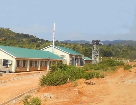
Conceptualized in 2009 along the northwest corner of Makueni County 60 km southeast of Nairobi via A109 Nairobi-Mombasa Road, in what was formerly a part of Malili Ranch, the 5000-acres Konza Technopolis more proper Konza ICT Park is set to be Kenya’s foremost technology oriented city. Konza Technopolis is a flagship project under Kenya’s Vision 2030, aiming to create a stellar technology hub and smart city. A mixed-utility high density walkable community. Dubbed “Africa’s Silicon Savannah,” it was designed to attract tech companies, startups, research institutions, and global investors to engender Kenya’s digital economy.
B y the same token, in 2012, the Ministry of Information, Communications and Technology retained a team of consultants led by New York City based HR & A Advisors, Inc., to prepare a detailed business plan and master plan for Phase One. The Master Plan Development Partner 1 (MDP1) team included SHoP Architects, Dalberg, Centre for Urban and Regional Planning, OZ Architecture and Tetra Tech. They designed Konza Technopolis with modern urban planning, including high-speed internet (fiber optics), smart grids, and sustainable energy solutions. There is focus on green spaces, pedestrian-friendly zones, and eco-friendly buildings.
On completion, Konza is envisioned as a top-notch technology city which will comprise an electronic manufacturing plant, an international finance centre, data centres and a living and leisure residential area for up to 185,000 people. Phase One of Konza ICT Park, which primary aims to develop its utilities, kicked-off in 2017. In addition, a privately-run tourism-oriented railway line from Konza ICT Park linking it to Lake Magadi and Kajiado is nearing completion. A fully functional city with over 200,000 residents and 17,000+ jobs is envisioned by 2030. Konza Technopolis aims to position Kenya as a top African tech hub, complementing and competing with Rwanda’s Kigali Innovation City and Nigeria’s Eko Atlantic City.

Cottage industries play a vital role in Kenya’s economy, particularly in rural areas where they provide employment and preserve traditional skills. These small-scale, home-based enterprises are diverse and contribute significantly to local economies. Cottage industries In Kenya are diverse and integral to the cultural and economic fabric. For the travellers, these offer colourful and friendly markets.
Index of Cottage Industries in Kenya


Embu County - Ancient Mbeere Terraces, Kakamega County - Ilesi Pottery Centre, Rosterman Mines, Kisii County - Tabaka Soapstone, Kwale County - Lima Self Help Group, Lamu County - Matondoni Boat Workshop, Manda Coral Mining, Machakos County - The Masaku Flea & Curio Market, Wamunyu Handicraft Society, Makueni County - Makueni Fruit Plant, Makindu Handicrafts, Migori County - Macalder Mines, Mombasa County - Fort Jesus Curio, The Bombolulu Workshop, Akamba Handicraft Society, Nairobi County - Masai Market, Utamaduni Craft Centre, Narok County - Kikoy Market, Vihiga County - Kichutu Gold Mine, Givavei Artisans, Obida Ombima Mill, Wajir County - Wajir Livestock Market, West Pokot County - Alale Gold Mines

outlook
Flanked by the A109 Nairobi-Mombasa Road on its eastern flank, Makueni County is part of the Lower Eastern Kenya region. Major towns like Mtito Andei and Emali serve as trade hubs along the A109, the former being the traditional halfway stop and rest. Other towns enroute are; Sultan Hamud and Kibwezi. Home to Akamba people, it is so commonly referred to Ukambani – alongside Kitui and Machakos.

You Are Here: Konza Technopolis
Where to Next?
Explore Destinations Nearby Konza Technopolis
A Guide to Makueni County


A Summa Digest of Makueni

About Makueni Way Back When

50 Destinations in Makueni County, arranged as one would visit these - north, east, west then south - with aid of narratives, images, strip maps and distance chart:

Mbooni Hills, Konza Technopolis, Kilima Kiu Manor, Mulima Dam, ACK Resort Salama, Makongo View Point, Katithini, Wote Green Public Park, Thwake Dam, R. Kaiti Bridge, Kampi ya Mawe, Kusyombunguo Hotel, Nzueni Hill, Nzaui Heritage Trail, Nzaui Rock, Mii Project, Makueni Cultural Center, AIC Kalamba, Kalamba Fruit Factory, Virgin Mary Rock, Emali Hills, Emali Trig, Ka Kindui Falls, Dare Devil's Rock, Kyanzizi Falls, Ilovoto Falls, Kyale Catholic Church, The Kenze Gorges, Kilungu Hills, Hunter's Lodge, Makindu Handicrafts, Makindu Sikh Temple, Mbiu Nzau Hills, Kambua Resort, Kivungoni Springs, Kibwezi Forest, Umani Springs, Chyulu Hills National Park, Kisula Caves, Tsavo West National Park, Tsavo East National Park, Yatta Plateau, Ngai Ndethya National Reserve, Kilalinda Conservancy, Tsavo Safari Camp, P. Cameron Camp, Patterson's Safari Camp

Know More About Makueni County: Its Geography, Land-Use, Highlights, Population, Roads - with the aid of strip maps, Airports, Climate & National Monuments


Makueni County’s terrain is generally low-lying, falling to 600 ms near Tsavo at the southern region. That is to also say, land rises from low-lying terrain of about 600 meters above sea level in the southern Tsavo area to higher elevations in the hills. Prominent ranges include the volcanic Chyulu Hills in the south-west, Mbooni Hills and Kilungu Hills.
Climate about Makueni varies based on altitude – with the north being cooler – 20oC to 24oC, while the south, more so during the dryer months, between May and October, experience generous heat.
