Discover Kenya’s Natural Landmarks

Marsabit County
21. Ndoto Mountains

Past Namunyak and Sera Conservancies, and passing through Losai National Reserve between the centeres of Merille and Laisamis (104 kms from Archer’s Post along the A2), the southern region of Marsabit County is marked by great alluvial inland peaks that downslope from 2752 ms declining to crests of 400 ms as you near Lake Turkana. “These are a chain of mountains consisting of old crystalline basement rocks, mainly of extremely durable gneisses and granites”. The steep Ndoto and Nyiru Ranges, reaching up to 2752 ms in southern area of Marsabit County are the highest. Next to these, a series of volcanic peaks like Mount Kulal (2285 ms), Mount Marsabit (1707 m) and Hurri Hills (1479 m) in the mid-west Marsabit County tower over the inland plains. Set at the southern boundary, north of Namunyak Conservancy and west of Losai National Reserve, Ndoto Mountains overlook the broad Kaisut Desert separating it from Mount Marsabit. A dense forest clads the upper reaches although much of the deeply-gullied sides and rocky peaks of remain exposed. This contrast pieces together a striking landscape. The tallest peak – Mount Poi – rises over 700 ms over the surrounding range. There are about a dozen or more cliffs rising over 500 m in height, many of these reaching as high as 300 ms and 1 kms in width. Ndoto Mountains are best seen at Ngurunit 71 kms west of Laisamis through Namarei.
22. Mount Nyiru

The C77 Baragoi-Loiyangalani Road to the southern edge of Lake Turkana goes though Ngurunit, South Horr and along the eastern flanks of Mount Nyiru. From Ngurunit it’s a 161 kms journey northerly to Loiyangalani across an arid bushland and is approachable from both north and south with accommodation options on both ends. Rising to 2,752 ms, Mount Nyiru is one of the highest mountains in the Northern Kenya. The western face of Mount Nyiru is topped with dark forests and some waterfalls, filled with the outpourings of the heavy clouds which often cap the summit; the eastern side much drier with more rock exposure. Due to its importance as a water tower, the 45 km2 forest around Mount Nyiru of which about 8 km2 is covered with true forest was gazetted, in 1956, as a forest reserve. A total of 448 plant species belonging to 104 families have been recorded on Mount Nyiru. The Samburu of Nyiru attribute a use to 249 species (56%) of the local flora. The adventure-lovers who hike up Mount Nyiru, in company of local Samburu guides, are rewarded with peerless cultural insights and mind-blowing vistas; Suguta Valley in the background, the Mowango Sowan Plains in the foreground, and in the middle distance sits the land that slopes towards the flat Rift Valley floor partly filled by Lake Logipi. The rhapsodized over Desert Rose Lodge is set-up on the south-western slopes.
23. Nabuyatom Cone

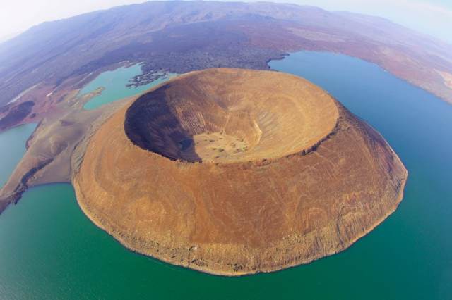
The discernible Nabuyaton Cone which in the Turkana dialect mean the “place of the war horn” is one of the rare examples of a perfect-cinder-volcano formed from the remnants of a collapsed deep volcano. Situated close to the southern peninsula of Lake Turkana, Nabuyaton Cone was made famous by aerial shots taken in 2011 by acclaimed photographer Martin Harvey while accompanying clients on exclusive helicopter safaris in Namibia, Botswana and Kenya. Despite its almost non-existent mention in modern travel chronicles, the oddity of the Nabuyaton Cone, which rises to about 384 ms, had been widely popular among early-day explorers including Count Teleki. It was a major landmark along the ‘Champagne Route to Abyssinia’ that passed through this region. Aside from its spectacular aerial photos, Nabuyaton Cone is inaccessible because of the steep rock walls. “On the foreshore some five miles away at the end of a stream of lava which seemed to issue from under my feet, stood the cone of Nabuyaton, from here as elsewhere a conspicuous feature of the landscape. On the left stood the great escarpment which I had descended 2 days before, and some fragmentary cones and curious boil-like hills lay scattered like islands in a sea of dark rugged rusty-looking black lava. – Britannica – In Search of the Teleki’s Volcano, 1928.
24. Mount Kulal

Of the landforms within Marsabit County, it is the chain of hills seen along the southwest border (having an average height of 2000-2500 ms and 1500-2000 ms above the surrounding landscape) that leave an indelible impression on the traveller. Equally impressive are the chain of hills which occur in the northeast area near the boundary with Ethiopia. These hills are not only critical in terms of the surface extent but are also important as water catchments areas. Among these important hills are Kulal, Marsabit and Hurri and their surrounding foot slopes. Located just east of Loiyangalani and Lake Turkana with a north-south strike, Mount Kulal is a biosphere with a variety of landscapes and habitats that are best seen along the hiking trails. The fact that Mount Kulal attracts plenty of rain promotes the growth of thick forests on the upper reaches and flourishes farmlands on the footslopes. In the lowest part of Kulal’s landscape where water stagnates, evaporation leaves in it wake salt pans. The Chalbi Desert north and east of Mount Kulal is the result of such a process: A saline area where plant growth is virtually absent due to toxic levels of salt in the soil. The eroded-down extinct mountain of Kulal, that rises to 1,800 ms, is widely known for its deep crater often capped by rain and mist forest. Of interest for travellers to Mount Kulal are the battery of hot-springs and panoramic vistas of Suguta Valley and Chalbi Desert both stretching away as far as the eye can see. Often veiled by a grey mist of clouds, Mount Kulal eminently marks the western end of Chalbi Desert that marches north-bound from here for almost 100 kms to North Horr.
25. Mount Marsabit

“Amidst the flat country, the pinnacles of the mountains announce the arrival of Marsabit, historically the principal centre of the Cushitic Rendille” – Nation Media. Quite unmistakable on arrival at Marsabit Town is the prominent peak of Mount Marsabit rising to 1,230 ms and the most prominent landmark for miles out and easily sighted from 20 kms out. Marsabit is reached by way of the A2 Road 96 kms north of Laisamis. Shortly before arriving at the main Marsabit Town this roads travels across an usually green belt and also separates Marsabit National Reserve and Marsabit National Park. Mount Marsabit and the verging series of smaller hills forms a small frontier of beautiful wooded greens betwixt the vast shrubland. Due to its elevation in altitude and mountain effect, the area around Mount Marsabit is opportune for agriculture and is assuredly the most densely populated area in Marsabit County. It is located 560 kms from Nairobi.
26. Gof Choba

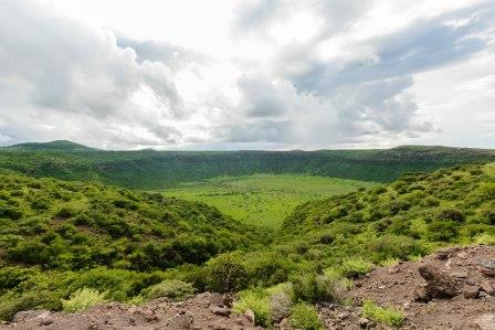
Gof Choba is located only 23 kms from Marsabit Town along the A2 Marsabit-Moyale Road near the KBC Transmitting Station. “Gof Choba is the whooper on the left – to the forbidding black moonscape of the Dida Galgalu Desert. Dida Galgalu means “plains of darkness”, according to one Boran Story – Richard Trillo. The cauldron like depression of Gof Choba is ringed by a scenic backdrop of hills, diverse flora and rugged plains. It is one of the more spectacular craters within easy reach from Marsabit National Reserve. Gof Ano and other smaller Gofs sits just 5 kms northeast of Gof Choba. Quite a common occurrence north of Marsabit, gofs speckle the landscape. Other notable Gofs include Gof Redo, Gof Dakara, Gof Bongore and Gof Anno. The craters are due to volcanic activity.
27. Hurri Hills

It is 43 kms from Maikona to Kalacha, resuming the expedition across Chalbi Desert. About 10 kms before arriving at Kalacha, cut from the same cloth with Maikona, you reach the turnoff to Hurri Hills – along C82 Road. That is to say, there are two routes linking Maikona and Kalacha – the E670 Road travelling away from the Hurri Hills and the C82 towards the Hurri Hills. From Kalacha it’s about 71 kms east then north to the hills. “The Hurri Hills, a remote region of large lava cones, is located between Chalbi Desert and the Kenyan-Ethiopian border in central-north Kenya. The Hurri Hills rise about 300 meters (985 feet) above the lava plateau, reaching 1524 meters (5000 feet) above sea level. Just north of the Hurri Hills, separated by a descending plain of black-cotton-soil, lies the granitic Mount Forole (1887 meters; 6200 feet). This sacred mountain marks the Kenyan-Ethiopian border” – National Geographic. The pyramidal series of peaks of the Hurri Hills, at hand with the Ethiopia-Kenya boundary, stage the abrupt end to the seemingly boundless outreach of the Chalbi Desert. Based on appearance alone their greenery is splendid – following the surfeit of the salt-encrusted desert – with over 20 conical low-lying hills. A short journey north of the Hurri Hills (1524 ms) you find the Sacred Mount Forore (1887 ms).
28. Sacred Mount Forore

The Sacred Mount Forore, a magnificent granitic mountain peaking at 1880 ms and marking the Kenyan-Ethiopian border, is at most times of year a plenitude of green, picked-up from where grandiose landscape of Hurri Hills ceases and across the barren plain that separates these two hills. Mount Forore, a facsimile of Hurri Hills, forming an astonishing green belt in contrast to the windswept sun-baked plain, is especially superb soon after the rains in May, June and July.
29. Sololo Escarpment

It’s unconvincing for any first-time trippers to Moyale not to get dumb-struck-in-awe by the towering monolith of the Sololo Escarpment at the doorstep of the Sololo township. This outstanding natural sculpture forms part of the stellar Sololo-Moyale Mountain Ranges which rise up to 1,400 ms in the northeast tip. The Sololo Escarpment, an adjunct of the Ethiopian Highlands, is marked by a perennial bushland thicket vegetation. From Sololo it is 83 kms east to Moyale.
Meru County
30. Kierra Ridge

As early as 1912 the Kierra Ridge (or the Kierra Hill) just east of Chogoria Town had attracted the attention of prospectors. During that year, Messrs A. Gamble and W. G. Parker pegged claims on the southwest flank of the Kierra Ridge to exploit the mica pegmatites occurring there. In 1942, the southern slopes of Kierra Ridge was yet again the subject of tantalizing geological prospects for mica and the possibility of the occurrence in them of minerals such as nickel and chronium ores. “Dr. W. Pulfrey had recognized the presence of plenteous masses of mineral rich basic rock. A reconnaissance of the area was, therefore, undertaken between April and November. 1948, to determine the extent of the basic rocks, degree of mineralization and the most favourable localities for the prospecting. The examination of the basic plutonics did not, however, give much promise”. North of the Kierra Ridge is a chain of picturesque conical hills.
Nakuru County
31. Mount Longonot

Well-known, the Rift floor commencing in the Naivasha area forms part of the structurally and topographically diverse Great Rift Valley. Among the numerous volcanic cones and craters, scarps and studs, the highest tip is formed by Mount Longonot which rises abruptly to 9,107 ft (2776 ms) to exemplify the contrast of scenery and ecology. The fetching landscape of this bulky and pitted dome lying isolated in the spacey Rift Valley also doubles as the most exalted hiking-trails in Kenya. Longonot is derived from the Maasai idiom “Oloonong’ot” translating to “the mountain of many spurs or steep ridges”. All in all, 52 km2 around the Mount Longonot was gazetted, in 1993, as the Mount Longonot National Park. It offers the avid hiker a breathtaking experience culminating at its crater forest with unbridled views of Lake Naivasha, Njorowa Gorge and outwith. It takes on average 6 hours (round-trip) to scout Mount Longonot. Major wildlife sighting includes buffaloes, elands, bushbucks, zebra, giraffe and gazelles. A small cover charge (Citizens – 300, Residents – 600 and Non-Residents – USD 26) is paid to enter the park. It is found 90 kms from Nairobi via Mai Mahiu-Nairobi Road.
32. Eburru Mountains

The 3,220 ft. tall Eburru Mountains, a double-peaked ridge which straddles the north and west peripheral area of Lake Naivasha, provides an exciting challenge for the nature-lover, and rewards the avid hiker with remarkable vistas. Its Maa sobriquet Ol Donyo Eburru, mountain of smoke, answers to one of the Eburru’s most interesting spectacles, that of the presence of steam jets – reminiscent of those seen at Olkaria (Hell’s Gate National Park) on the south and east of the lake. Unique to the Naivasha area is that “there is no basin of heated ground-waters, but that juvenile fluids are escaping from depth at places and mixing with the ground-water, conditions being suitable at certain places where there are fissures for the production of steam, which escapes at surfaces”. The small Eburru Wellhead Geothermal Power Plant by KenGen is set-up on the northern foot-slopes. The Eburru Mountains, a part of the active complex of volcanoes in the Great Rift Valley system, is typified by Cedar hills, deep-valleys and rolling foothills. The 8,715-hectares skeletal and indigenous Eburru Forest resembles that seen on the younger Mount Longonot, and on the badlands of Elementaita.
33. Subukia Valley

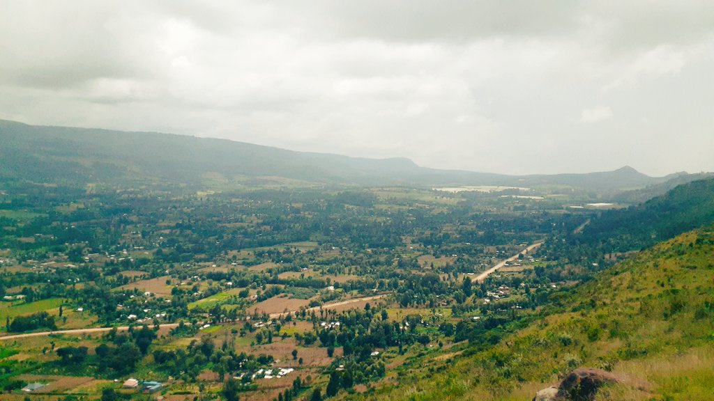
End to end, the 11 kms drive along the winding road across the Subukia Valley – trending north-west to south-east – is one of exceptional and engrossing views. Also dubbed as the Bahati-Subukia Horst, the valley is considered an outlying spur of the Rift Valley’s eastern wall, both from a tectonic viewpoint and from the nature of its component rocks coinciding with part of the main eastern wall of the Rift Valley. By the same token, it is a result of major faulting, originating the Rift Valley, which caused the enormous displacement along the escarpment. The actual faults are mostly obscured by later eruptions and faults that include the Subukia earth quake of 1928 measuring 6.8 on the Richter Scale, that is the largest recorded seismic event in the Kenya rift; and rather unorthodox to the cast of Rift Valley’s character in which large earthquakes are rarely anticipated.
34. Menengai Crater

On a long day out in Nakuru you can combine visits to Lake Nakuru National Park, Hyrax Hill Museum and Menengai Crater. The latter, north of Nakuru, can be accessed from either east or west. In the former case access is from the Nyahururu-Nakuru Road and in the second from Nakuru-Kabarak-Sigor Road. Either way, a visit here brings one to a site of romantic beauty. The views, once you reach the rim of the caldera, are well worth the effort. The highest ground is situated to the south and north-west of the caldera – an immense pit 56 km2 in extent which is bounded by an almost vertical wall only absent in a few short sectors of the caldera’s perimeter. To the south, the volcanic pile of Menengai rises, the country becoming less broken as the caldera is approached and the fault scarps gradually die out. The caldera floor itself is filled with a confusion of slaggy bouldery lava flows and cinder cones piled up to form a central eminence at 6,858 feet. Menegai Crater is East Africa’s second widest following the world-famous Ngorongoro Crater in Tanzania. The slopes of Menengai are in general fairly gentle, and while most people come to enjoy the sight from the viewing point, a select band of plucky hikers, every now and then, attempt the arduous walk down to the cauldron’s floor. Menengai is located 10 kms north of Nakuru.
Nandi County
35. Nyando Escarpment

Nandi County comprises of five distinct topographic features – the rolling hills (west), Kapsabet Plateau, Tinderet volcanic mass, King’wal Swamp, and the Nyando Escarpment. The latter, which reaches 1800 ms at its highest elevation and forming part of the hill where Kisumu City is set, marks the casual border between Kisumu and Nandi Counties. It rises from the foot of Kajulu Hills in the outskirts of Kisumu and spreads past the moribund Miwani Sugar Factory towards Chemelil and Koru on the Nyanza-Rift Valley border. The Escarpment comprises of extremely rugged terrain, typified by granite and volcanic rocks. The Equator runs along its scarp-line. Its most rugged region, as you cross the Kano Plains, doubles as a wondrous roadside attraction and a hiking trails that culminates at the Nandi Rock sometimes known as the monkey rock – a stellar vantage point with vistas of Kisumu, Lake Victoria and Nyando Belt. Along the Londiani-Kisumu Road, “one can see River Nyando coursing along the hills on its way to Lake Victoria, along with many other rivers flowing under bridges”. The Nyando Escarpment has gained unwelcome notoriety owing to the inter-tribal clashes, between the Dholuo and Nandi Tribes. “The undertones from the Nandi Community points to the fact that; the communal boundary has been moved up from Awasi to Chemelil, translating to occupation of the Luo in what ‘deservedly’ belongs to the Nandi People. Secondly, de-gazette and revert back to Nandi naming of the landmark within their locality. What is now gazzetted as Nyando Escarpment should rightfully be called Nandi Escarpment”. The trail to stroll up Nyando Escarpment commences at Miwani, 21 kms from Kisumu City.
36. Nandi Scarp

Best sighted from elevated areas inside Kakamega Forest Reserve like Lirhanda Hill, the Nandi Scarp (not to be confused with Nyando or Nandi Escarpment) is one of the striking geological features in the west and northwest areas of Nandi. Rising in the South Nandi Forest (originally known as Kapwaren Forest), just south of the Kakamega-Kapsabet Road and just 3 kms to its western boundary with Kakamega County, this forms a natural barrier between the North Nandi Forest and Kakamega Forest Reserve. The main scarps rise to 5400 to 6600 ft over most of its length, and then south of Kakamega-Kapsabet Road proximate to South Nandi Forest it rapidly dies out. Isolated features such as Chapkaigat, Tabolwa, Kimoror, and Sumayat atop the Nandi Scarp rise to well-over 7000 ft.
37. Nandi Hills
Not to be confused with Nandi Hills Sub-county and Nandi Hills Town, these hillocks of roughly equivalent height forming the Nandi Hills in the mid-south region of Nandi County, a short hop west of South Nandi Forest, are one of its most hallowed landforms. The prepossessing landscape around these typically flat-top ridges with identical summits, postulated to be remnants of an eroded plain, are exemplified by fine sweeps of expansive tea estates. Superbly sighted along C37 Kapsabet-Nandi Hill Road, they are a great launch for evening walks. Nandi Hills Town, the second busiest town in Nandi County (after Kapsabet), set on the Nandi Hills, has many hotels that make for suitable starting-points to explore the area. “On the south side of Nandi Hills Town, at Kapsimotwo, is the Morobi Hill, where the aged used to voluntarily end their lives by plunging into an escarpment in a ceremony called Sheu” – Standard Media. Then, there’s the Koitalel arap Samoei Museum built in honour of the legendary Nandi Hero who led the anti-colonial revolt in this region. A visit to Nandi Hills should not omit a look-see of the much-lauded Kapsimotwa Gardens and the Nandi Bears Club.
Narok County
38. Nguruman Escarpment

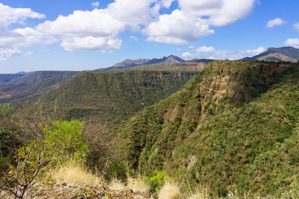
Not far west of the Shompole Conservancy about the foothills of the Nguruman Escarpment, there is an explosion of interesting craggy beauty, that covers the eastern boundary of Narok with Kajiado and from the boundary with Tanzania northward to Mau Complex. The Nguruman Escarpment, which is the western scarp of the Great Rift Valley, is a belt of dissected country about 16 kms wide extending along the eastern boundary of Narok. From near Mount Suswa, 160 kms north of Shompole, the Nguruman proceeds as the Mau Escarpment before it terminates near Mau Narok as it forms part of the forested Mau Highland. A popular hiking destination with many ways to it, Nguruman Escarpment offers fantastic views of the Great Rift Valley and its lakes, Loita Hills and its forests, and, of course, the Entasopia Falls, one of Nguruman’s most sought-after jewel.
39. Loita Hills

Not far west of the Shompole Conservancy about the foothills of the Nguruman Escarpment, there is an explosion of interesting craggy beauty, that covers the eastern boundary of Narok with Kajiado and from the boundary with Tanzania northward to Mau Complex. The Nguruman Escarpment, which is the western scarp of the Great Rift Valley, is a belt of dissected country about 16 kms wide extending along the eastern boundary of Narok. From near Mount Suswa, 160 kms north of Shompole, the Nguruman proceeds as the Mau Escarpment before it terminates near Mau Narok as it forms part of the forested Mau Highland. A popular hiking destination with many ways to it, Nguruman Escarpment offers fantastic views of the Great Rift Valley and its lakes, Loita Hills and its forests, and, of course, the Entasopia Falls, one of Nguruman’s most sought-after jewel.
40. Siria Escarpment

Siria Escarpment, also known as the Oloololo or Ol Donyio Escarpment, over 6,000 feet high and sloping westwards with the Mara River at its eastern foot, forms a break roughly down the western side of Masai Mara National Reserve and Narok County. It rises 1,000 feet over the surrounding flat plains, breaking the unvarying and unrelenting grassland monotony, to form one of the Mara’s most distinguished features which is especially wondrous when sighted at the Angama Mara Lodge set-up on Siria Escarpment’s edge. Near Mwita, the Siria reaches its highest elevation of about 6,500 feet, where the ridges forming the northern extension of the Karri Highlands occur. West of Siria Escarpment, the surface slopes towards Lake Victoria (3,500 feet) at about 35 feet per kilometre.
